

NavTrail
- 7.1
2350Evaluation
- 9330+
downloads
- 16+
Over 16 years old
NavTrail
Your Off-Road Companion
• NavTrail is the essential toolkit for adventurers who leave the pavement behind.
• Designed for overlanders and 4x4 enthusiasts, it combines rugged navigation with a connected community to help you explore forest roads and remote wilderness with confidence.
Important Safety Disclaimer
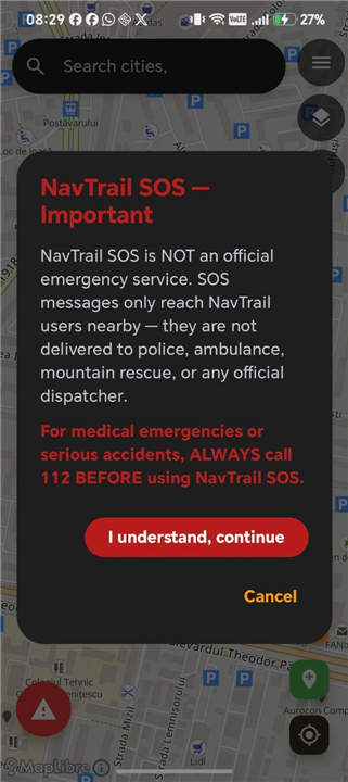
• The NavTrail SOS function facilitates peer-to-peer assistance and is NOT an official emergency service.
• It does not alert police, mountain rescue, or dispatchers.
• In the event of a medical emergency or serious accident, always contact local emergency services (such as 112) first.
Navigation and Mapping
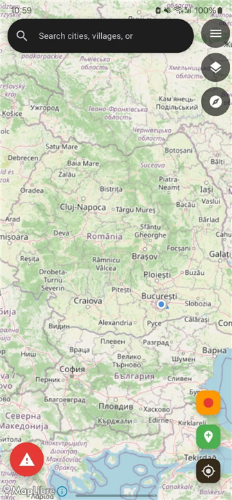
• Offline Capability: Access maps in airplane mode with no artificial size limits; your storage is the only boundary.
• Map Styles: Switch between Standard, Topographic, Overland, and Satellite views.
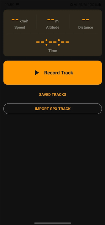
• GPS Recording: Log tracks with screen-off support, import/export GPX files, and replay your journeys with altitude and speed data.
Community and Situational Awareness
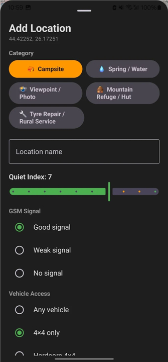
• Points of Interest: Discover and contribute camping spots, springs, and vital service locations, moderated by the community.
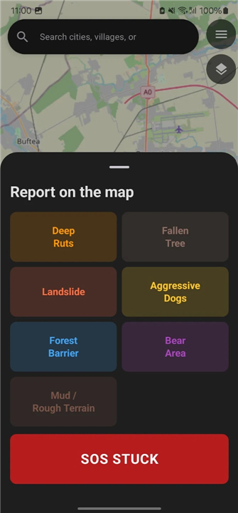
• Hazard Alerts: Share and view real-time trail obstacles—like landslides, fallen trees, or wildlife—with auto-updating reports that keep the map current.
• Community SOS: Request specific peer support, such as mechanical assistance or fuel, from other users in your immediate vicinity.
Convoy and Performance
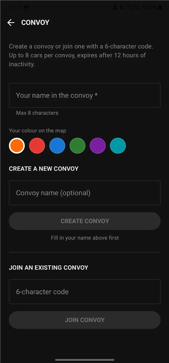
• Live Tracking: Coordinate groups of up to 12 vehicles with secure, shareable codes for real-time positioning.
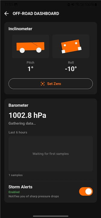
• Off-Road Dashboard: Utilize built-in tools including an inclinometer, a device-based barometer for storm detection, and a tire-pressure calculator tailored to your terrain.
Privacy and Integrity
• Data Protection: We respect your privacy. The app contains no ads, no third-party analytics, and no tracking SDKs.
• Controlled Sharing: Your location is only visible to your active convoy members and only while you choose to share it.
For more information, visit our website or contact us at contact@navtrail.app.
FAQ
Q: Can I trust the NavTrail SOS function in a medical emergency?
A: No, you should never rely on the NavTrail SOS function for medical emergencies or life-threatening accidents. This tool is strictly designed for peer-to-peer assistance, such as requesting a jump-start or fuel. If you are in a serious emergency, please prioritize contacting local official emergency services like 112 immediately.
Q: What happens if I have a mechanical breakdown on the trail?
A: You can use the Community SOS feature to request specific help from other NavTrail users in your immediate vicinity. Whether you need mechanical assistance or a few liters of fuel to get moving again, this function connects you with nearby adventurers who can provide support.
Q: How does the live tracking feature work for group trips?
A: NavTrail allows you to coordinate groups of up to 12 vehicles using secure, shareable codes. Once you join a session, you can see the real-time positioning of your fellow convoy members on the map, making it much easier to stay together on complex trail systems.
Version History
v1.0.0——14 Jul 2026
Off-road navigation — offline OSM maps, GPS, convoy, hazard reports. Download the latest version of NavTrail to enjoy new features and updates immediately!
*1.0.0
Minor bug fixes and improvements. Install or update to the newest version to check it out!
- Version number1.1.4
- System Requirements5.0 and up
- Is there a feeFree(In game purchase items)
- AppSize6.66M
- AppLanguage English
- PublisherNavTrail.app
- Package Namecom.overtrailro.app
- MD5
- Content RatingTeenDiverse Content Discretion Advised
- Privilege19
-
NavTrail 1.1.4Install
6.66M2026-09-13Updated










7.1
6627 Human Evaluation
- 5星
- 4星
- 3星
- 2星
- 1星