Maastokartat
- 7.4
2762Evaluation
- 9888+
downloads
- 16+
Over 16 years old
Maastokartat
Overview
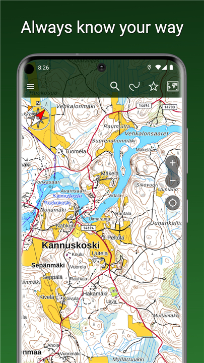
• Embark on your next adventure with Maastokartat, your essential companion for seamless outdoor exploration.
• Discover hidden trails, navigate new landscapes, and always know your way, whether you're trekking through forests or sailing vast waters.
Your Free Path to Discovery
Maastokartat offers powerful, free features to guide your journey:
1. Comprehensive Topographic Maps:
• Access highly accurate maps of Finland, Sweden, Norway, Denmark, and Estonia, all powered by official national survey data.
2. Stunning Imagery:
• View detailed aerial imagery from Finland and explore the globe with worldwide satellite views.
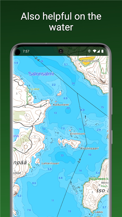
3. Nautical Charts:
• Navigate Finnish waters confidently with official nautical charts.
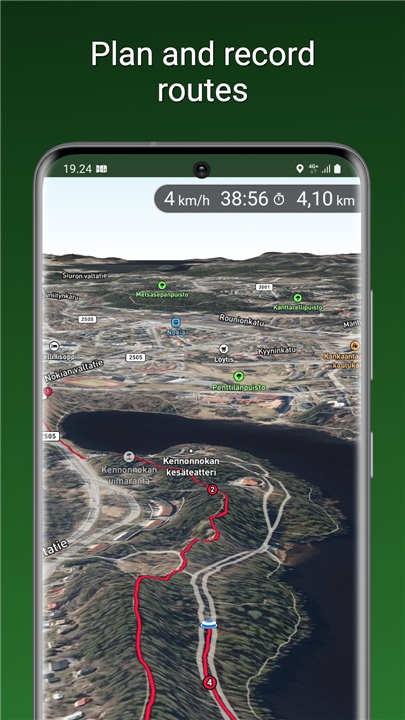
4. Real-time Navigation:
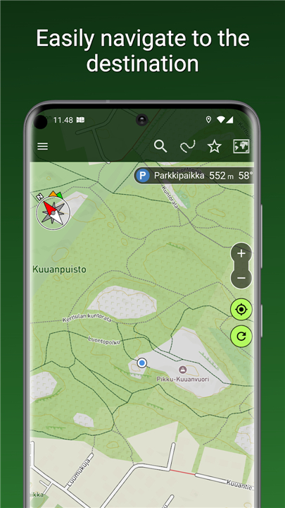
• Pinpoint your exact location, track your movements, and navigate to any destination with clear direction and distance displays.
5. Advanced Tools:
• Utilize multiple coordinate formats (WGS84, ETRS-TM35FIN, MGRS, etc.), a dynamic compass, distance measurement, and robust search capabilities.
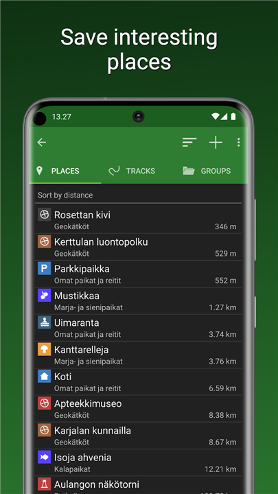
6. Personalized Exploration:
• Save your favorite places, organize them into groups, and seamlessly share or import GPX files with fellow adventurers.
7. Data Security & Health:
• Back up your data to Google Drive and monitor your heart rate with BLE sensor compatibility.
Unlock Enhanced Exploration with Maastokartat Plus
Elevate your outdoor experience with a Maastokartat Plus subscription, unlocking a suite of premium features designed for the most demanding explorers:
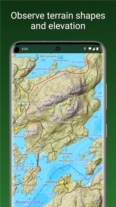
1. Unrivaled Map Detail:
• Dive into highly detailed topographic maps featuring elevation differences via hillshading and critical water depth information.
2. Immersive 3D Views:
• Experience landscapes anew with stunning 3D aerial and satellite imagery.
3. Worldwide Outdoor Map:
• Expand your horizons with a comprehensive global outdoor map based on OpenStreetMap data.
4. Freedom to Roam:
• Download maps for offline use, ensuring you always have guidance, even without an internet connection.
5. Seamless Sync & Safety:
• Enjoy automatic cloud synchronization of your places and tracks across all your devices, and share your live location with trusted companions.
6. Advanced Planning & Tracking:
• Record your traveled routes, meticulously plan future journeys, and draw areas to measure surface dimensions.
7. Property Insights:
• Access property boundaries and identifiers layered directly onto your maps for added information.
Extend your capabilities for just €9.90 for a three-month adventure, or embrace year-round exploration with an annual subscription at €19.90, averaging only €1.66 per month.
FAQ
Q: Which countries are covered by the comprehensive topographic maps in Maastokartat?
A: You'll have access to highly accurate topographic maps for Finland, Sweden, Norway, Denmark, and Estonia. These maps are powered by official national survey data, ensuring their reliability and detail for your explorations.
Q: Can I use Maastokartat for navigation on water, like lakes or the sea?
A: Absolutely! Maastokartat includes official nautical charts specifically for Finnish waters. This feature allows you to navigate confidently and safely when exploring the Finnish archipelago or inland waterways.
Q: What kind of imagery does Maastokartat offer beyond standard maps?
A: You can enjoy stunning imagery, including detailed aerial views from Finland that give you a bird's-eye perspective. Additionally, Maastokartat provides worldwide satellite views, allowing you to explore any part of the globe visually.
Version History
v2.8.5——5 May 2026
Finnish topographic maps on your phone and tablet Download the latest version of Maastokartat to enjoy new features and updates immediately!
*2.8.5
Added a setting to lock the map orientation to north.
*2.8.4
Added a setting to lock the map orientation to north.
*2.8.1
- The contrast of hill shading has been improved.
- Support for the ETRS-Gn coordinate system.
- Coordinate system can now be changed easily directly next to the coordinates. Previously, this had to be done through the settings.
- Coordinate display formats have been unified.
- Support for Android 16.
- Version number2.8.5
- System Requirements5.0 and up
- Is there a feeFree(In game purchase items)
- AppSize13.99M
- AppLanguage English
- PublisherMapsiTech Oy
- Package Namecom.swampsend.maastokartat
- MD5
- Content RatingTeenDiverse Content Discretion Advised
- Privilege19
-
Maastokartat 2.8.5Install
13.99M2026-05-06Updated


7.4
7726 Human Evaluation
- 5星
- 4星
- 3星
- 2星
- 1星