
GMapper GIS GPS & Area Measure
- 9.5
9944Evaluation
- 4964+
downloads
- 16+
Over 16 years old
-------✦ INTRODUCTION ✦------
GMapper GIS GPS & Area Measure is a cutting-edge application designed to provide users with high-precision mapping and geographical measurement capabilities.
Whether you are a professional surveyor, an agriculturist, or a casual user, GMapper offers a comprehensive suite of features that make land surveying and management easier and more accurate than ever.
-------✦ KEY FEATURES ✦------
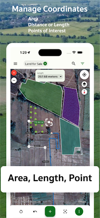
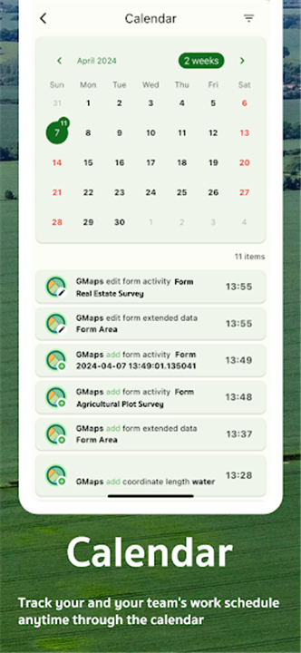
Survey Data Logging
Record survey details with customizable forms, ensuring that all necessary information is captured during your surveying activities. This feature enhances the accuracy and reliability of your survey data.
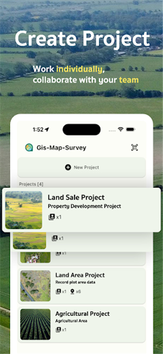
Collaboration
Work efficiently with your team on surveying and land management projects. GMapper facilitates collaboration by allowing multiple users to access and contribute to shared projects, improving productivity and communication.
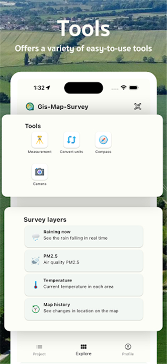
Unit Conversion
Quickly and accurately convert between various measurement units, making it easy to work with different standards and requirements. This feature is particularly useful for users who operate in diverse regions with varying measurement systems.
Compass
Navigate your travels with a high-precision compass integrated into the app. This tool helps users orient themselves and find their way in unfamiliar terrain.
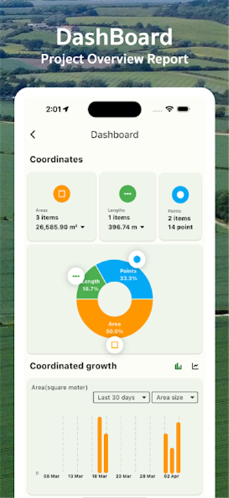
GPS Map Camera
Use your device's camera to measure coordinates and display them on a GPS map. This innovative feature allows for real-time mapping and enhances the overall surveying experience.
------✦ COUNTRY OF ORIGIN AND LANGUAGE ✦------
Country: Thailand
Original Language: English
------✦ RECOMMENDED AUDIENCES ✦----
GMapper GIS GPS & Area Measure is ideal for a wide range of users, including professional surveyors seeking precise measurement tools, agriculturists needing to assess land for farming, and resource managers planning terrain usage.
Additionally, casual users interested in exploring maps and managing geographical data will find the app beneficial for personal projects and activities.
Frequently Asked Questions (FAQ) :
Q: What types of coordinates can I work with in the app?
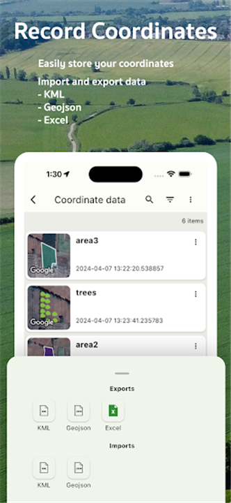
A: The app supports various coordinate types, including latitude/longitude, DMS, UTM, MGRS, and Geohash.
Q: Is the app suitable for beginners?
A: Absolutely! GMapper’s user-friendly interface makes it accessible for users of all experience levels.
Q: Can I collaborate with others on surveying projects?
A: Yes, GMapper facilitates collaboration, allowing multiple users to work on shared projects efficiently.
---------------------------------------
Contact us at the following sites if you encounter any issues:
Official Website: Here
Email: gis.map.tech.innovator@gmail.com
---------------------------------------
Version History
v1.9.5 ---- 13 Jun 2025
Measure & map land precisely with our GPS, GIS survey, and meter tools. Download and install old versions of GMapper GIS GPS & Area Measure that suits your device model and enjoy your favorite features!
- Version number1.2.6
- System Requirements5.0 and up
- Is there a feeFree(In game purchase items)
- AppSize53.38M
- AppLanguage English
- PublisherGis Map Tech Innovator
- Package Namecom.gis.map.survey.gmaps
- MD5a66a480c3ced38470e8517332ea89d8d
- Content RatingTeenDiverse Content Discretion Advised
- Privilege19


-
GMapper GIS GPS & Area Measure 1.2.6Install
53.38M2026-01-31Updated


9.5
5630 Human Evaluation
- 5星
- 4星
- 3星
- 2星
- 1星