
BalticMaps
- 8.9
6843Evaluation
- 2061+
downloads
- 16+
Over 16 years old
------✦ INTRODUCTION ✦------
BalticMaps is a powerful navigation and mapping app designed specifically for exploring Latvia, Lithuania, and Estonia.
It combines detailed cartography with practical tools such as GPS positioning, address search, and historical map browsing.
------✦ KEY FEATURES ✦------
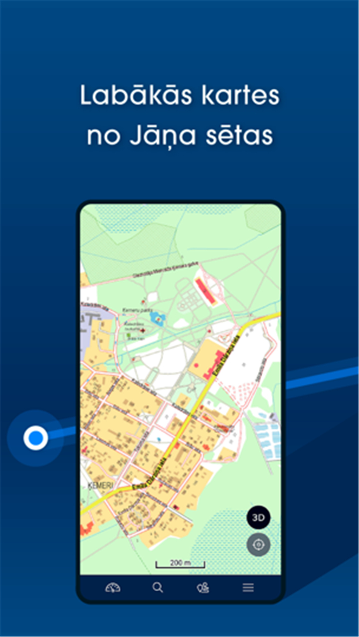
High-Quality Baltic Maps:
Browse detailed digital raster and vector maps of Latvia, Lithuania, and Estonia created by Jana seta.
GPS and Location Identification:
Use your device’s GPS to view your current location and determine the nearest address, WGS/LKS-92 coordinates, or place a custom marker.
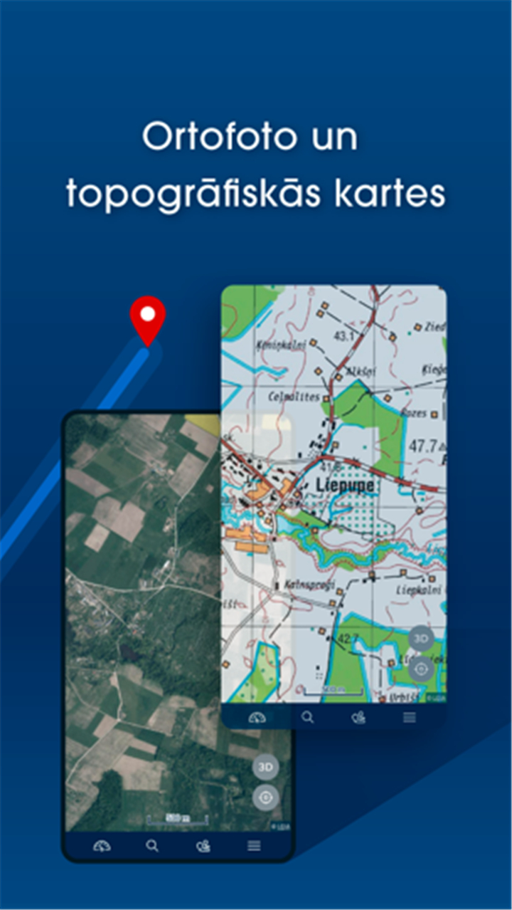
Map Layer Variety:
Explore different map types including contemporary and historical topographic maps of Latvia, as well as orthophoto maps for Latvia and Estonia.
Location Sharing and Feedback:
Easily share map locations or report errors in map content for improved accuracy and updates.
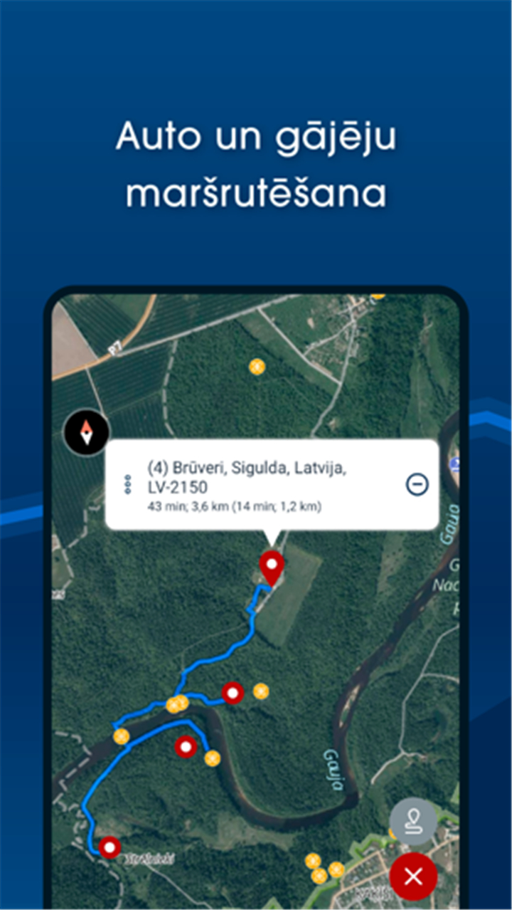
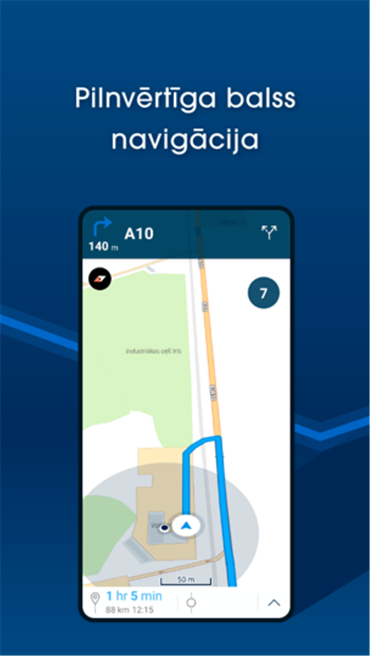
Turn-by-Turn Navigation (Subscription):
Access full voice-guided navigation for cars and pedestrians, supporting up to 50 waypoints for complex routes.
Comprehensive Place Search (Subscription):
Search for addresses, towns, rivers, lakes, and other geographical features throughout the Baltic States.
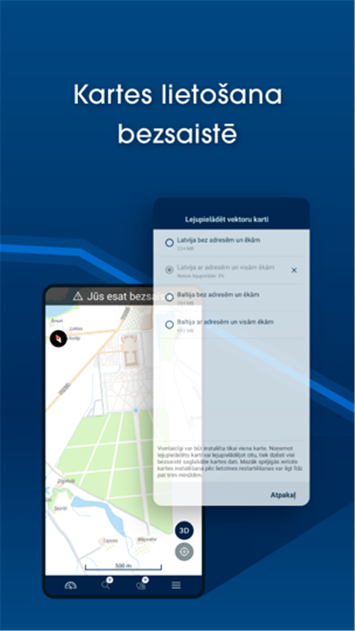
Offline Map Access (Subscription):
Download vector maps for offline use, making it ideal for areas with limited connectivity.
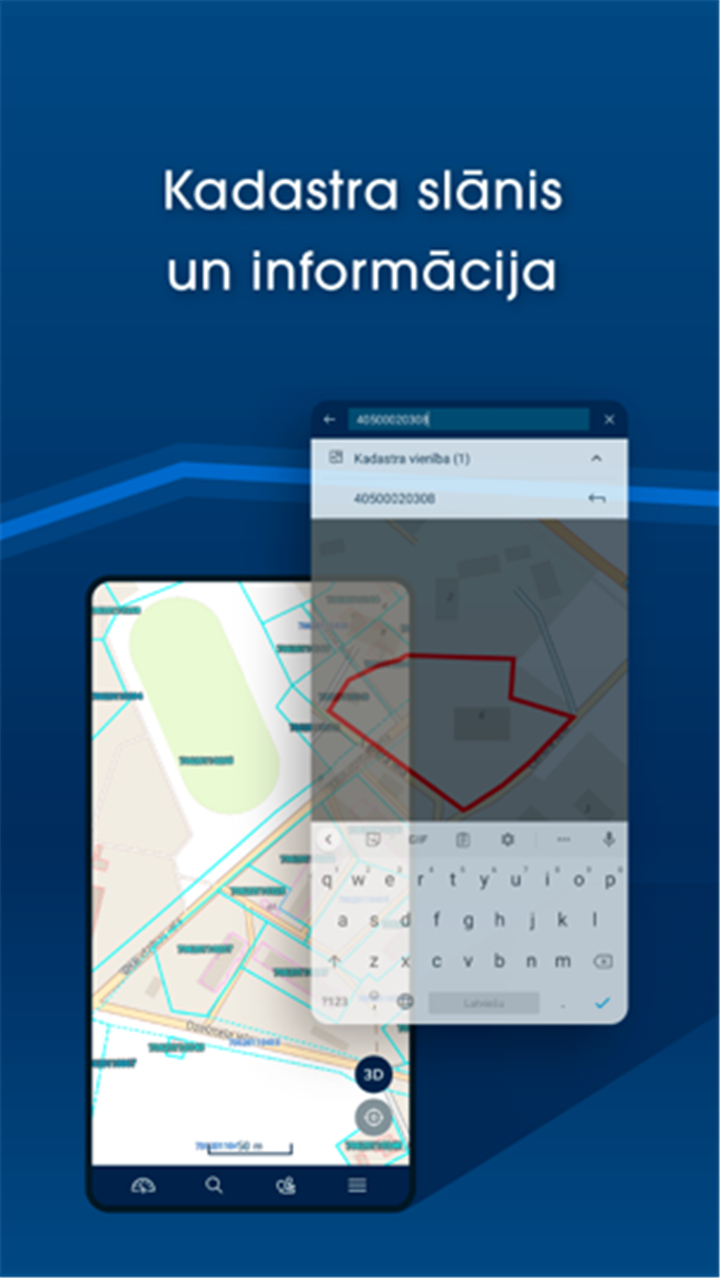
Cadastre Data and Parcel Search (Latvia Only, Subscription):
Access and search cadastre information, parcels, and buildings within Latvia directly from the map.
Live Traffic Information (Subscription):
View real-time traffic updates every five minutes in Riga and the Pieriga region to avoid congestion.
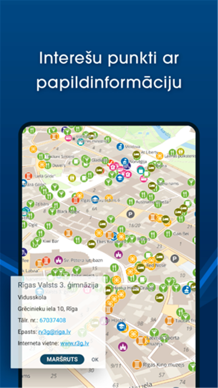
Favorites and POI Display (Subscription):
Bookmark locations, view points of interest, and see speed cameras marked clearly on the map.
Baltic Hiking Trails (Subscription):
Discover long-distance trails such as the Forest Trail, Baltic Coastal Hiking Route, and Latgale Lake Trail.
Geo File Importing (Subscription):
Import and view GeoJSON, GPX, or KML files for route planning and geographical data overlays.
------✦ COUNTRY OF ORIGIN AND LANGUAGE ✦------
Country: Latvia
Original Language: Latvian
------✦ RECOMMENDED AUDIENCES ✦------
BalticMaps is ideal for travelers, outdoor enthusiasts, drivers, hikers, surveyors, and residents of Latvia, Lithuania, and Estonia who need accurate maps, navigation tools, and location-based data.
Frequently Asked Questions (FAQ) :
Q: Can I use BalticMaps for free?
A: Yes, the free version allows you to browse digital maps, use GPS, view historical maps, and share locations.
Q: What does the subscription include?
A: Subscribing unlocks voice navigation, offline map downloads, detailed search, cadastral data, traffic updates, hiking trails, and more.
Q: Can I view historical maps with the app?
A: Yes, historical topographic maps of Latvia are available in the free version.
------------------------------------------
Contact us at the following sites if you encounter any issues:
Official website: here
Email: android@kartes.lv
------------------------------------------
Version History
V6.2.2 ------ 2 Jan 2025
Bug fixes and improvements.
- Version number4.2.5
- System Requirements5.0 and up
- Is there a feeFree(In game purchase items)
- AppSize39.75M
- AppLanguage English
- PublisherJāņa sēta SIA
- Package Nameeu.balticmaps.android
- MD566ad71da6caf26242d38fe300c4c6eb7
- Content RatingTeenDiverse Content Discretion Advised
- Privilege19

-
BalticMaps 4.2.5Install
39.75M2026-03-15Updated


8.9
4783 Human Evaluation
- 5星
- 4星
- 3星
- 2星
- 1星